
Pacifica's Single Verified ZIP: 94044
The research identified 94044 as the verified ZIP serving Pacifica street-delivery neighborhoods from Fairmont through Pedro Point, Linda Mar, and Park Pacifica. No separate unique ZIP or PO-box-only Pacifica ZIP was verified. The ZIP code directory therefore begins with one row and a clear warning: postal service geography and municipal boundaries are different layers.
| ZIP | Areas covered | Post office service | Notes |
|---|---|---|---|
| 94044 | Verified Pacifica street-delivery neighborhoods, including Fairmont, Pacific Manor, Sharp Park, Fairway Park, Vallemar, Rockaway, Linda Mar, Park Pacifica, and Pedro Point | Pacifica / Manor and Linda Mar stations | One postal ZIP does not prove municipal residency; compare the GIS city boundary |
No ZIP split or realignment year was established in the official sources reviewed. A search result should say “94044” rather than inventing a second local ZIP or a boundary date.
Pacifica Post Offices, One ZIP
Two Pacifica facilities serve the same ZIP. The Pacifica Post Office is at 50 W Manor Drive, Pacifica, CA 94044-1845, with the research file listing 650-355-1280 and retail hours of weekdays 9 a.m. to 5 p.m. and Saturday 9 a.m. to noon. The Linda Mar station is at 690 Roberts Road, Pacifica, CA 94044-9991, with 650-359-2935 and retail hours of weekdays 10 a.m. to 5 p.m. and Saturday 10 a.m. to noon. USPS also provides a general ZIP Code resource entry point for broader postal questions.
A post office facility is a service point, not a resident boundary. The same ZIP can have more than one counter, carrier route, or delivery pattern. Confirm a questionable address through the USPS address lookup, then compare the result with the county parcel and city layers.
The USPS lookup screen used for address verification appears below.
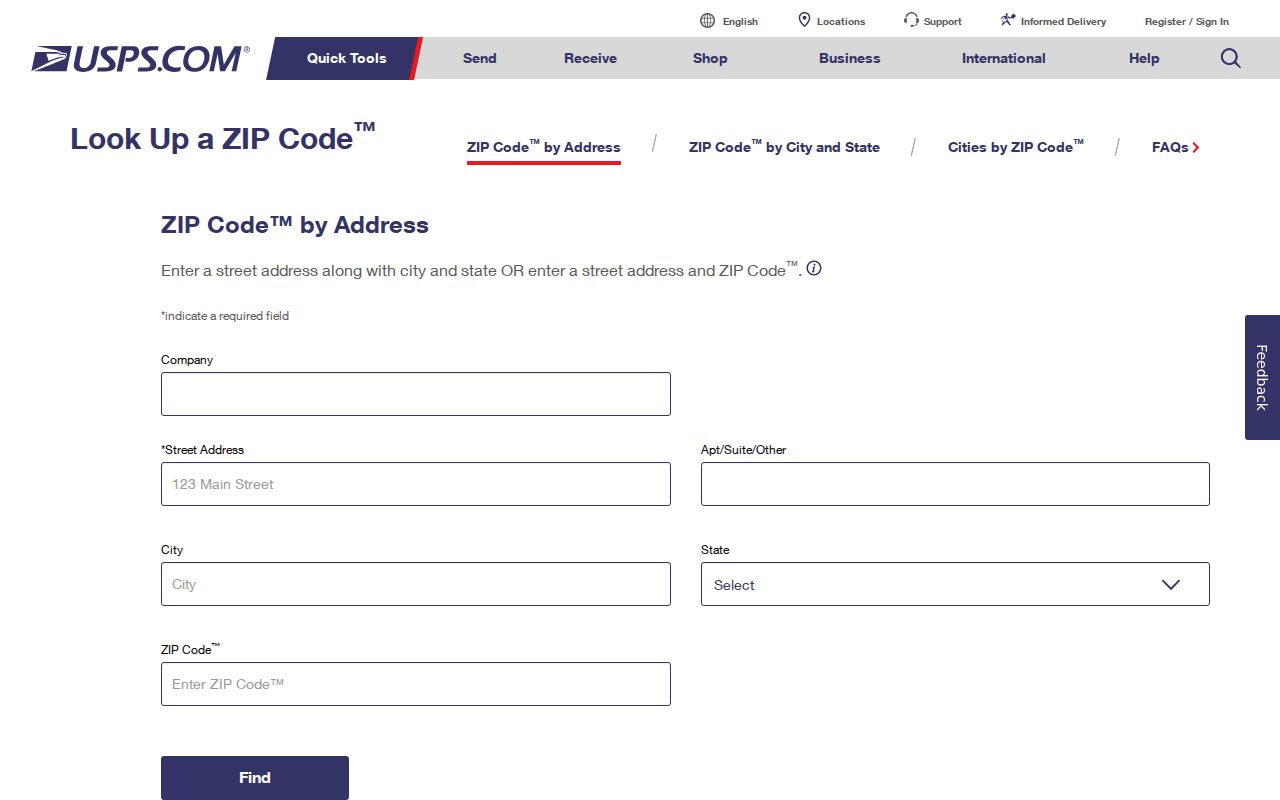
The linked tool can validate a mailing ZIP. It cannot answer who lives at the address or whether a postal label matches the city limit.
Pacifica ZIP Resident Search
A ZIP directory search works as a narrowing step. California does not publish a public voter street list, and the county assessor workflow is address or APN centered rather than a general public owner-name directory. Use the ZIP to organize known addresses, not to request a bulk list of people.
- Confirm the mailing ZIP with USPS by entering the full street address.
- Open the San Mateo County Property Information Portal and search the exact address.
- Compare the parcel's SITUS_ZIPCODE and SITUS_CITY fields with the ZIP Codes and City Boundaries layers.
- Save the APN and legal description, then move to deeds, permits, planning files, or a dated historical source.
- Use a lawful, purpose-approved state or county voter-file route only when the requester qualifies under California rules.
Once a ZIP narrows the search to a street, the Pacifica street directory by-address workflow owns the parcel and deed chain. A postal code is useful context, not the final person key.
Pacifica ZIP and City Layers
San Mateo County GIS places ZIP Codes and City Boundaries in the same map service. Parcel points expose SITUS_ADDR, SITUS_CITY, SITUS_STATE, SITUS_ZIPCODE, APN, coordinates, and the city or unincorporated indicator. Viewing those fields together is the cleanest way to test whether a 94044 mailing address is also inside Pacifica's municipal line.
Pacifica recreation material treats a resident as someone inside city limits and treats a Pacifica post office box as nonresident. That local definition reinforces the same lesson: postal service, a PO box, a parcel's physical situs, and municipal residency are not interchangeable. No verified 94044 street-delivery pocket outside Pacifica was identified, so the mismatch should be explained conceptually rather than illustrated with an invented exception.
| ZIP layer | Postal geography used for delivery and address matching. |
|---|---|
| City boundary | Municipal geography used to test Pacifica jurisdiction. |
| SITUS_CITY | City value attached to the physical parcel point. |
| PO box | Mailing location that does not by itself locate a person or parcel. |
Search Pacifica ZIP Code Directory
When several addresses share 94044, the APN is more precise than the postal code. Property Maps accepts an address or a nine-digit APN without dashes. The county viewer can overlay parcels, maps, districts, precincts, ZIP Codes, and city limits. RecorderWorks then provides a name-index route for recorded documents, while permits and planning rows can add a dated project clue.
The APN does not make a bulk ZIP search possible. The public viewer's owner-name, mailing-address, value, exemption, and ZIP-filter result fields were not verified. Search the known address or parcel, preserve the result, and ask the custodian for a focused record when a portal stops.
- ZIP versus ZIP+4
- ZIP identifies a broader delivery area; ZIP+4 adds a delivery segment and is not a resident identifier.
- PO-box ZIP
- A ZIP used for post-office-box delivery; no separate Pacifica PO-box-only ZIP was verified.
- Unique ZIP
- A ZIP assigned to a specific organization or facility; none was verified for Pacifica.
- Carrier route
- A postal delivery route within the broader ZIP, not a public household list.
This is why a postal directory should hand exact street work to a parcel map, not infer residents from postal geography.
Neighborhoods Inside 94044 by Development Era
Pacifica's one verified ZIP contains places built in different periods and shapes. Early railway and coastal communities include Sharp Park, Vallemar, Rockaway, and Pedro Point. Postwar growth added Fairmont, Pacific Manor, and Linda Mar. Park Pacifica reflects a later 1970s pattern. The directory can hold them in one postal row even though the street forms, map sources, and historical vocabulary differ.
Use a neighborhood term as a search variant, not as a proof of a parcel boundary. Sharp Park's grid may be easy to browse street by street. Pedro Point's narrow hillside roads and custom lots may require a legal map. Linda Mar's tract records may use a subdivision name. The APN and legal description keep those variants connected.
Official neighborhood names and development-era descriptions are listed by the City of Pacifica neighborhoods resource.
Pacifica ZIP Maps and Permits
A ZIP can help sort a known set of addresses before a permit or planning check. The Pacifica Building Division and active planning applications list are address keyed. County GIS can add precinct, legislative, supervisor, tax-rate, subdivision, and parcel layers. Those sources are useful for civic and property research, but they do not expose a ZIP-wide resident directory.
The field map below reflects the verified controls and parcel attributes. It intentionally leaves out a bulk owner-name or ZIP-filter promise because the research did not capture one.
| Field or layer | Type | What it contributes | Limit |
|---|---|---|---|
| Find by ADDRESS | Search mode | Locates a known parcel | Needs an address |
| Find by APN | Search mode | Locates a nine-digit parcel | Not a ZIP-wide people search |
| ZIP Codes | GIS layer | Shows postal geography | Not municipal residency proof |
| City Boundaries | GIS layer | Shows Pacifica jurisdiction | Compare the exact parcel |
| SITUS_ZIPCODE / SITUS_CITY | Parcel attributes | Displays the physical address fields | Does not name occupants |
| District and precinct layers | GIS overlays | Adds civic geography | Not a casual voter list |
A 94044 search is most useful when it starts with a known address and ends with a documented parcel result. Save the USPS response, the county map date, and the values displayed for SITUS_CITY and SITUS_ZIPCODE. If those values disagree, do not choose the one that fits a hoped-for conclusion. Ask the county GIS or city custodian which boundary controls the particular record.
The city-side trail can then add an active planning application, permit status, or district overlay. The ZIP organizes the first pass, while the APN and legal description make the result reproducible. A records request may be the fallback for an older permit, but the request should name an existing file rather than ask officials to create a ZIP-wide list.
After the ZIP step, a focused address request can go to the city, county, or another record custodian. A request should ask for existing records and identify the address and time period.
Unverified Pacifica ZIP Facts
The research did not locate a Pacifica ZIP split year, realignment program, unique institution ZIP, PO-box-only ZIP, per-ZIP population, or bulk owner search mode. It also did not verify a street-delivery pocket outside the city. Those gaps matter because a polished ZIP directory can sound more certain than its sources.
State the verified fact narrowly: 94044 serves Pacifica street delivery, two post offices serve the same ZIP, and county GIS lets a researcher compare postal and municipal layers. Do not convert an unverified boundary assumption into a resident list. For older address work, retain the APN, legal description, neighborhood label, and record date.
For family history or civic research, a Pacifica ZIP code directory can be a useful index to the right map, library question, or city custodian. It can group a known set of addresses, help compare neighborhood eras, and flag when a postal label needs a city-boundary check. It cannot supply a complete list of residents, replace an authorized voter-file process, or resolve a deed by itself. The strongest result names the ZIP, the exact parcel or address, the date, and the office that holds the underlying record.
Geography tip. One 94044 ZIP covers varied railway, postwar, and 1970s neighborhoods. Use the city boundary and parcel situs to test jurisdiction.
A Pacifica ZIP code directory is most accurate when it explains what the postal number can narrow and what it cannot identify. The final person or parcel claim belongs to the relevant custodian.